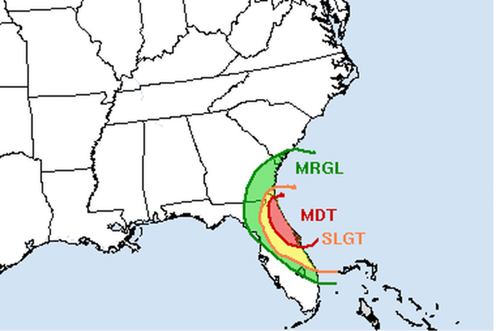
JACKSONVILLE, Fla. — The National Weather Service in Jacksonville has a Flood Watch for Duval, St. Johns, Flagler, Clay and Putnam counties until 7 p.m. Friday. Several rounds of heavy rain are expected to hit the same areas through the end of the week. The watch calls for 3 to 8 inches of rain through Friday night, with locally 12 inches or more, and warns of urban and small stream flooding, especially along the coast.
Bands along Interstate 95
Strong high pressure is wedged down the Southeast coast, with a trough of low pressure just offshore and a stalled front over the southeastern Gulf. Forecasters say the setup is lifting moist ocean air over northeast Florida and sending bands of moderate to heavy rain north-northwest along the Interstate 95 and U.S. 17 corridors. Wednesday evening’s discussion calls for another 3 to 6 inches in the watch area, with more in spots, especially along the coast.
The offshore trough is expected to grow into a deepening low to the southeast on Friday and Friday night. Showers continue through Friday night, mainly near the coast, and bands could bring heavier totals to some neighborhoods.
Worst at high tide
Forecasters say flooding will be worst along the coast around high tide, when rain has the hardest time draining. Minor tidal flooding is possible around high tide this weekend, even after the heaviest rain ends.
Wind, surf and rip currents
Onshore winds at the northeast Florida beaches could reach 20 to 25 mph, with gusts of 35 to 40 mph. High Surf Advisories and a high rip current risk cover every area beach into the weekend, and small craft advisories are up offshore, with occasional gale-force gusts.
The St. Johns River is rising
The river flows north from Brevard County toward Palatka and Jacksonville, and the National Weather Service in Melbourne has Flood Warnings along its upper reaches. Near Cocoa, the river was at 17.3 feet on Wednesday afternoon, above its 16-foot flood stage and in major flood. The forecast holds it near that level, but the office says more heavy rain over the next 48 hours could push it toward the record late this week or this weekend. At this level, water enters homes in the Lake Poinsett area west of Cocoa and low-lying homes in Rockledge’s Silver Pines subdivision.
Farther north, moderate flooding above Lake Harney is forecast to reach major flood stage. The river is in minor flood at Sanford and rising, DeLand was forecast to pass flood stage Wednesday evening, and onshore winds are pushing water up the river toward Astor.
Cities affected
- Jacksonville, Fla.
- St. Augustine, Fla.
- Palm Coast, Fla.
- Palatka, Fla.
- Orange Park, Fla.
What to do
- Never drive through a flooded street. Turn around and find another way.
- Move cars out of low spots before high tide.
- Stay out of the ocean while the surf and rip currents are dangerous.
- If you live along the St. Johns River, follow the river forecasts at water.noaa.gov.
Lodi Valley Chronicle publishes a new U.S. weather briefing every morning.