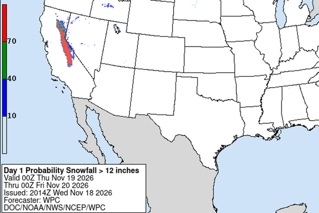
SHAVER LAKE, Calif. — The National Weather Service in Hanford raised its snow forecast for the southern Sierra Nevada on Wednesday morning. Its Winter Storm Warning, in effect until 4 a.m. Friday, now calls for 1 to 3 feet of snow above 5,000 feet, up from 1 to 2 feet on Tuesday, and around 4 feet above 8,000 feet. Gusts could reach 45 mph. The warning covers Yosemite National Park outside the valley, Kings Canyon and Sequoia national parks, the Grant Grove area and the mountains around Shaver Lake.
Another round Thursday
Hanford’s forecasters expect moderate to heavy precipitation through Friday morning. They say travel could be very difficult to impossible during the Wednesday evening and Thursday morning commutes.
Farther north, the Sacramento office expected the heaviest snow through Wednesday afternoon and again from Wednesday night into Thursday afternoon, falling at 1 to 2 inches an hour or more.
Interstate 80 and Highway 50
Sacramento’s Winter Storm Warning for the northern Sierra and southern Cascades also runs until 4 a.m. Friday. It calls for 2 to 4 feet of snow above 5,000 feet, up to 5 feet on the highest peaks, and 6 to 15 inches between 4,000 and 5,000 feet. Gusts up to 60 mph could cause near-whiteouts. The warning covers Interstate 80, Highway 50 and state routes 4 and 108. Snow levels of 4,000 to 5,500 feet could dip briefly to about 3,500 feet early Friday.
Up to 4 feet on Donner Pass
The Weather Service in Reno said Truckee and South Lake Tahoe were already reporting light snow by midday Wednesday. It expected the heaviest snow, 2 to 3 inches an hour, on Wednesday afternoon around Lake Tahoe and Wednesday evening in Mono County. By Friday morning, it expects 1 to 2 feet in the Tahoe Basin, with more on the west side, and up to 4 feet on Donner Pass along Interstate 80. Mammoth Lakes could get 3 to 4 feet, June Lake 2 to 3 feet and U.S. 395 in Mono County 6 to 12 inches. Ridgetop gusts of 90 to 100 mph are still expected through Thursday, and waves on Lake Tahoe could reach 5 feet.
On the range’s east side in Inyo County, the Las Vegas office expects 10 to 18 inches between 5,000 and 8,000 feet and 18 to 36 inches up to 9,500 feet, with whiteouts.
Snow in Reno, storms in the valley
Snow levels drop below 5,000 feet late Wednesday night into Thursday morning, and Reno’s forecasters expect slick, icy roads for the Thursday morning commute. They call for 1 to 4 inches along the Sierra Front, 5 to 8 inches in Virginia City and 4 to 8 inches in Susanville.
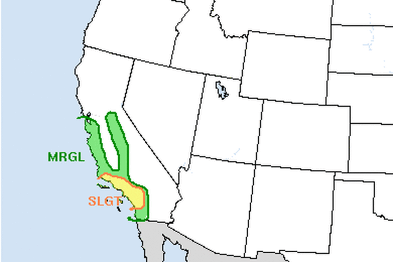
West of the Sierra, Hanford expects 1 to 3 inches of rain below 5,000 feet. The Storm Prediction Center has a marginal risk of severe thunderstorms on Thursday for parts of the San Joaquin Valley, the Sierra foothills and Yosemite, with a 2% chance of a tornado, gusts of 60 mph or more and small hail. Forecasters say their confidence in severe storms is low.
Bitter cold, then more storms
Skies clear Friday afternoon, and very cold air follows. Reno’s low on Saturday morning is forecast at 10 to 13 degrees, with single digits in Truckee. A weaker storm could bring snow back from Saturday night into Monday, and forecasters are watching a potentially stronger one for Tuesday into Wednesday, just as Thanksgiving travel picks up.
Cities affected
- Shaver Lake, Calif.
- Truckee, Calif.
- South Lake Tahoe, Calif.
- Mammoth Lakes, Calif.
- Reno, Nev.
What to do
- If you can, put off Sierra crossings until the storm ends Friday morning.
- If you must drive, carry chains, a full tank, water, food, a flashlight, blankets and warm layers.
- Check Caltrans QuickMap (quickmap.dot.ca.gov), NDOT or 511 for chain controls and closures.
- Expect icy roads Friday night and Saturday morning, when temperatures drop into the teens and single digits.
Lodi Valley Chronicle publishes a new U.S. weather briefing every morning.