HOOPER BAY, Alaska — The National Weather Service in Fairbanks has issued a Coastal Flood Warning for the Yukon Delta coast from 3 a.m. Wednesday to 3 p.m. Thursday, Alaska time. Water could reach 4 to 6 feet above the normal high tide in Hooper Bay and 2 to 4 feet above it elsewhere along the coast. Southeast winds could gust as high as 55 mph.
Two high tides on Wednesday
Hooper Bay will see two high tides Wednesday, and the second is expected to run slightly higher than the first. Southeast winds turn more southerly by Wednesday morning. The Weather Service says moderate coastal flooding is likely in Hooper Bay. Roads may close, use of the airstrip may be limited, and low-lying homes, businesses and some critical infrastructure could flood. Shoreline erosion is possible.
The local forecast calls for east winds around 45 mph Tuesday night and southeast winds around 45 mph on Wednesday, with snow turning to rain and snow.
Gusts to 80 mph in the islands first
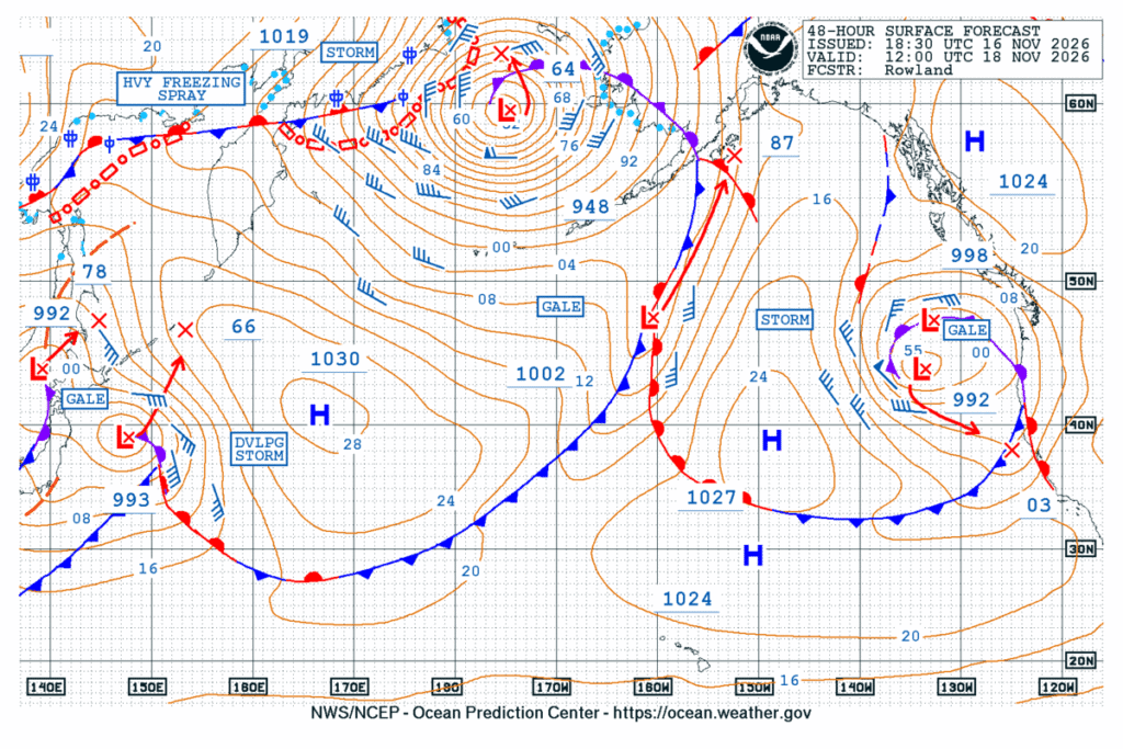
The Weather Service in Anchorage says a strong low-pressure system is moving through the Bering Sea. A High Wind Warning for Atka and Adak runs from 6 p.m. Monday to 6 a.m. Tuesday, with southwest winds of 45 to 60 mph. Gusts could reach 80 mph on Adak and 60 mph on Atka, with the strongest winds early Tuesday morning.
Big seas off St. Paul
On the Pribilof Islands, a High Wind Warning runs from 3 a.m. to 9 a.m. Tuesday, with southeast winds of 45 to 55 mph and gusts up to 75 mph. Winds shift to the west by Wednesday morning, and a second round from Tuesday evening into Wednesday morning could gust to 60 to 70 mph. Waves of 20 to 30 feet are expected within 15 to 20 nautical miles of St. Paul through Thursday morning.
Wind inland, too
Farther east, the Weather Service in Fairbanks has a High Wind Warning for the eastern Alaska Range north of Trims Camp from midnight Tuesday night to 3 p.m. Thursday. South winds of 35 to 55 mph with gusts up to 80 mph could make driving difficult, especially for high-profile vehicles, and could cause a few power outages.
What the warning means
A Coastal Flood Warning means flooding is expected, not just possible. The Weather Service urges people to protect flood-prone property and never to drive around barricades or through water of unknown depth.
Cities affected
- Hooper Bay, Alaska
- St. Paul, Alaska
- Adak, Alaska
- Atka, Alaska
What to do
- Move vehicles, boats and supplies to higher ground before Wednesday’s high tides.
- Never drive or walk through water of unknown depth.
- Tie down loose objects and be ready for power outages.
- Check with your airline or air carrier before flying; airstrip access may be limited.
Lodi Valley Chronicle publishes a new U.S. weather briefing every morning.